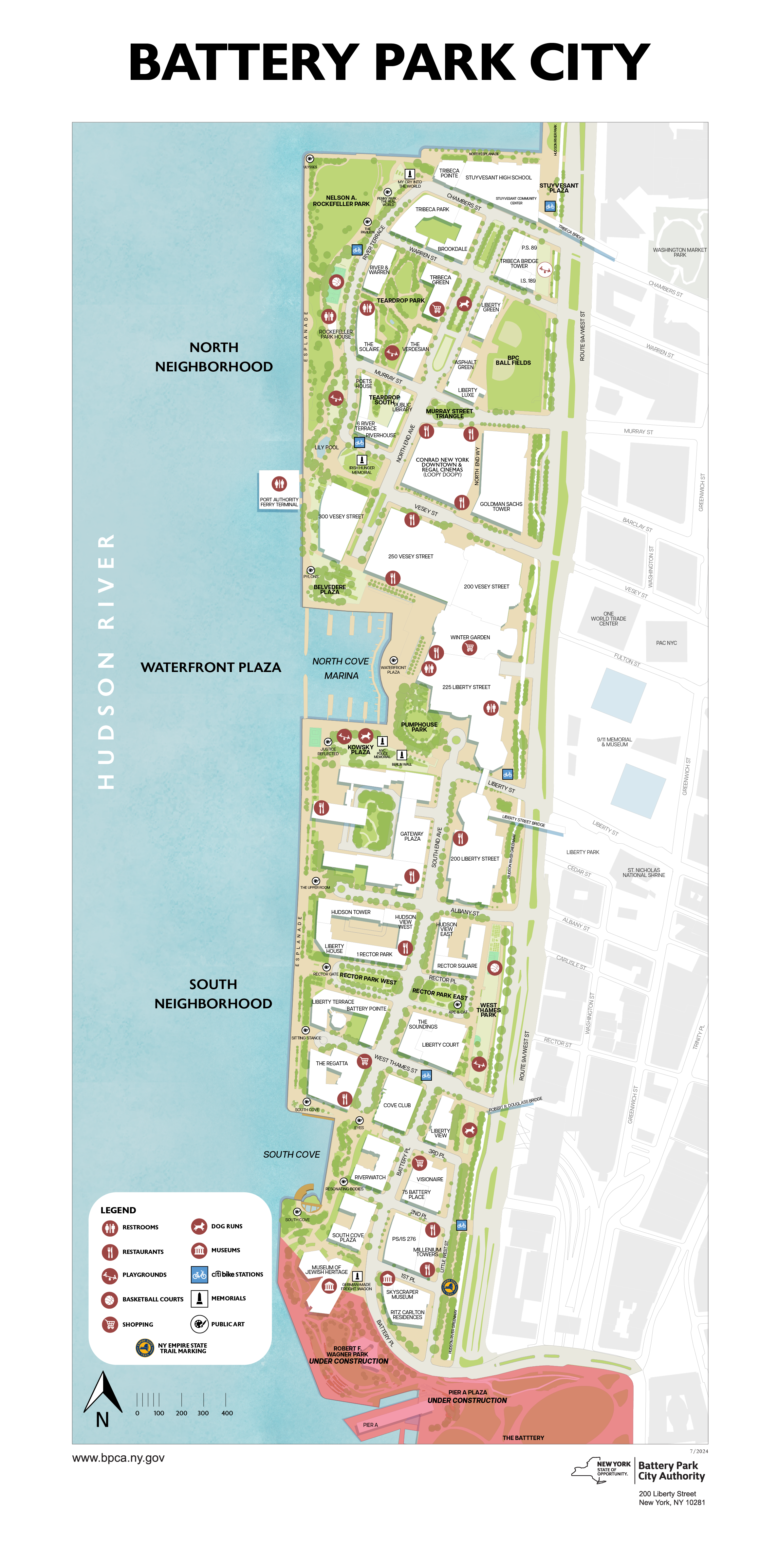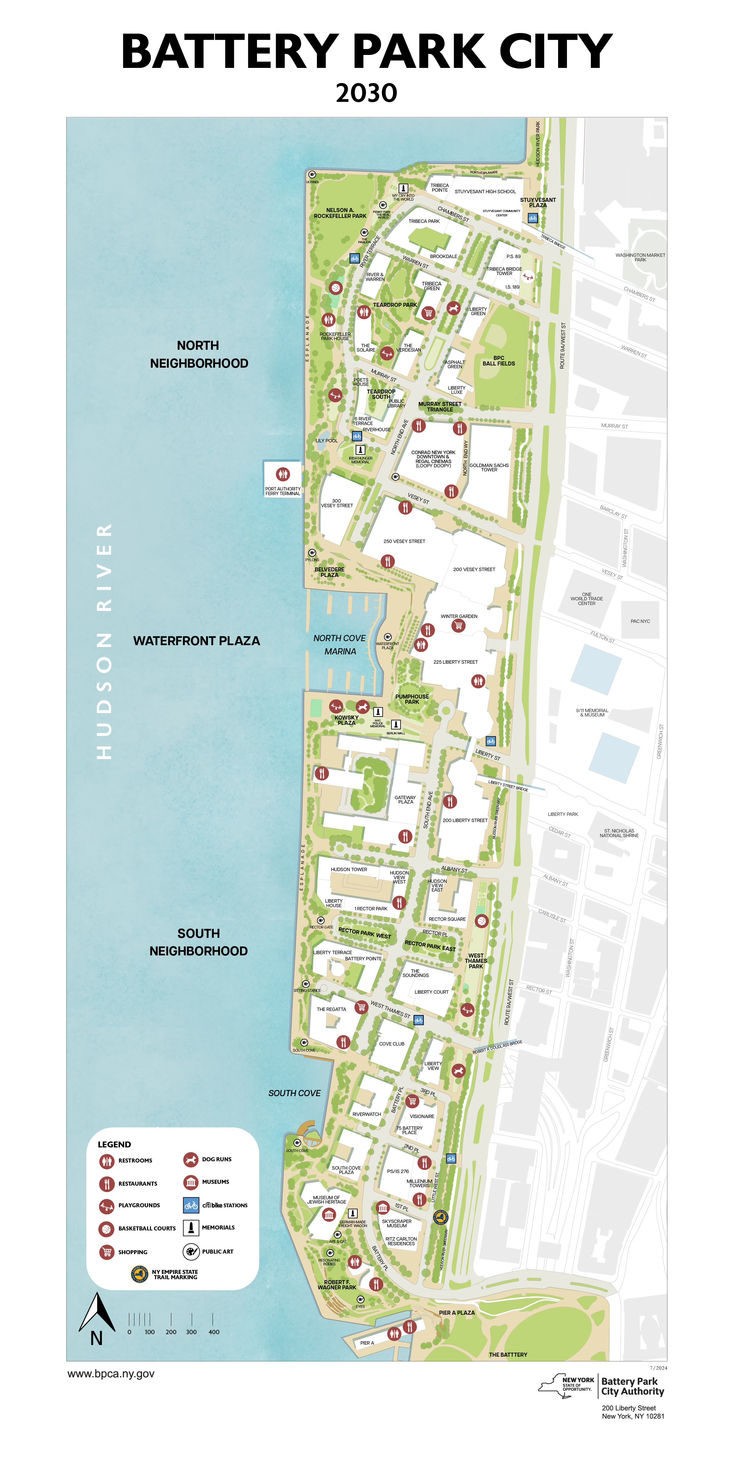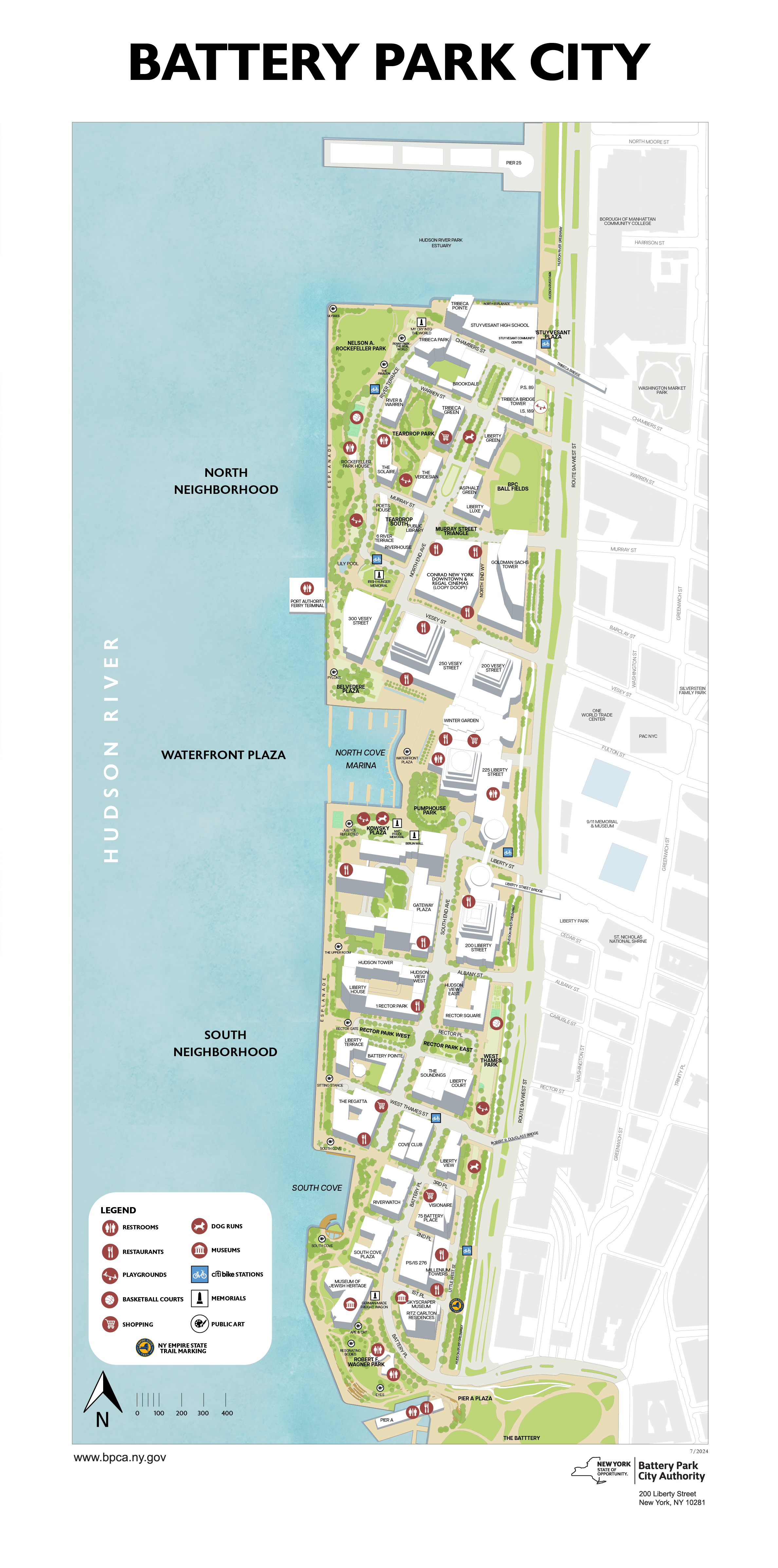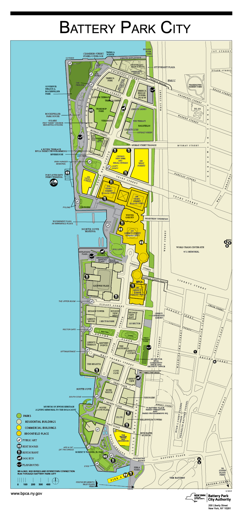
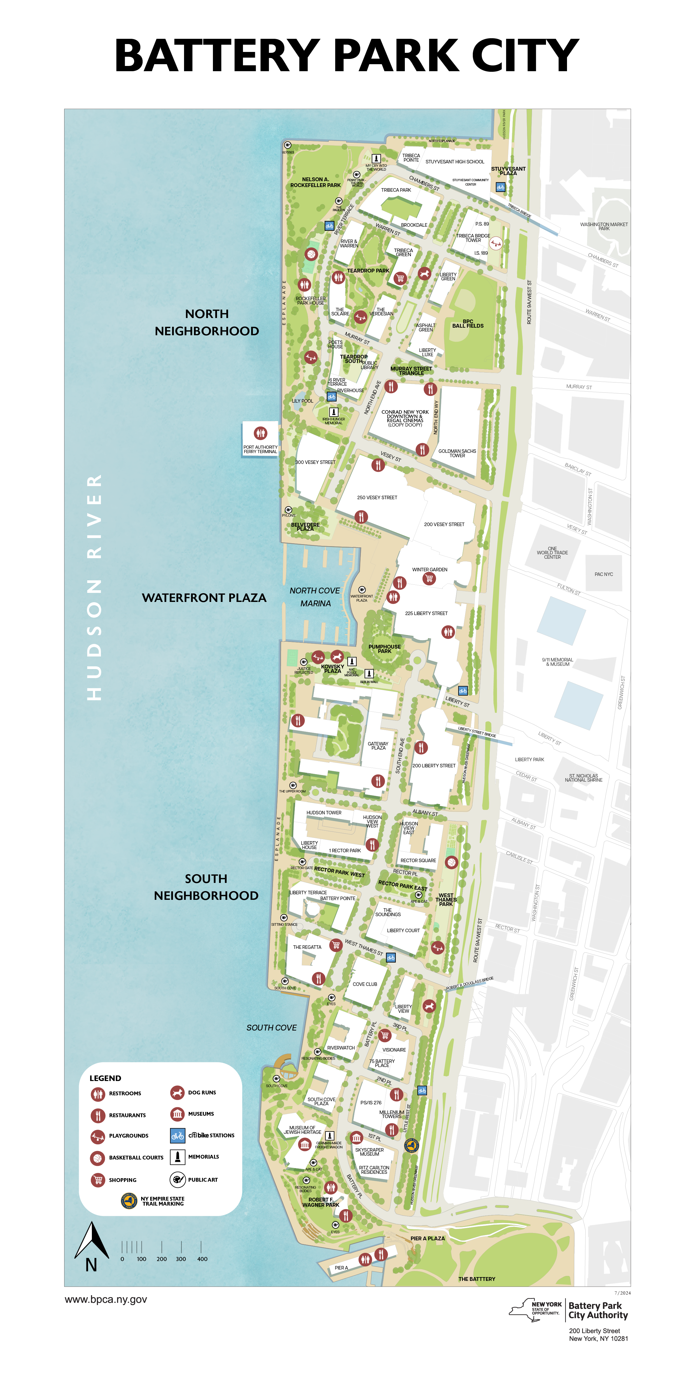
The largest task during my time with Battery Park City Authority was the redesign of the neighborhood map. Battery Park City is currently working on a large-scale redesign of the neighborhood to protect the land from future flood risk. (For more information: https://bpca.ny.gov/nature-and-sustainability/resiliency/)
This new map would include the redesign of Wagner Park, as well as greenspace redesigns, pictured in the 2030 map below. My biggest priority for this redesign was providing more context. To achieve this, building footprints were added as well as the 9/11 memorial pools. I had also wanted the neighborhoods’ greenspaces to pop out more, which is the reasoning behind the tree information being added. More icons were included as well, including a memorials icon and citibike station icon.
Completed for: Battery Park City Authority
Completed: 07/2024
Assignment Type: Internship
Programs Used: Adobe Illustrator, ArcGIS
Skills Utilized: Map Design, Graphic Design
Battery Park City Map Redesign
OTHER VERSIONS
